Chicago, IL - Venice, FL
(12-16 Jul 2006)
Map generated by the Great Circle Mapper - copyright © Karl L. Swartz.
Another wonderful chance to stretch the Mooney's legs and aqcuire some serious cross-country time. My parents had visited us in June and driven back to Florida with my 9 year old son. Two weeks later my wife and 3 year old flew down to Venice, FL (just south of Sarasota on Florida's West Coast) for a visit. I had almost a week of leave and flew down with our dog to avoid kennel fees. Plan was to visit for a few days and then bring our son back the same day my wife and daughter flew back commercially -- we'd leave around lunch time and pick them up from Chicago's Midway airport when they got in that evening...
Flight planning showed I could make it non-stop from Chicago to Venice, but it would be pushing it on fuel reserves and I didn't want to have to deal with fuel issues when facing the daily summer afternoon thunderstorms Florida is famous for, so I used Airnav to look for cheap fuel and found a great location at Griffin-Spalding County airport (6A2) south of Atlanta and under the Class B airspace. 6A2. Another factor in the calculations was the limitations on my altitude as I'd be travelling with our English Setter Nelson who obviously would not be willing to wear an oxygen mask or cannula, so I flightplanned for between 10 and 13 thousand feet).
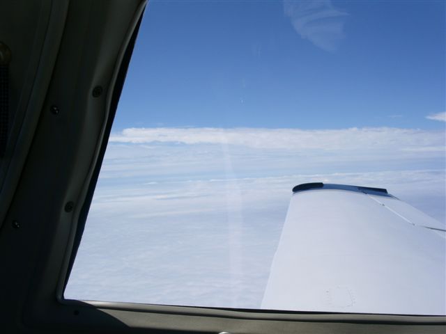
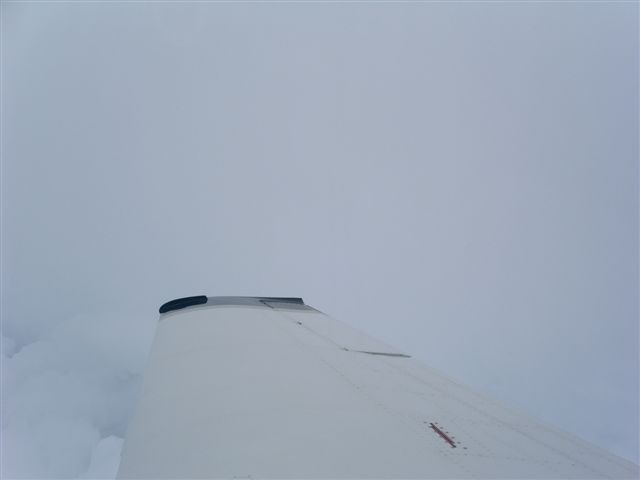
Day of departure was bright with relatively clear skies over Chicago and several thunderstorms in the southeast but generally good flying weather showing around the route of flight. Got everything loaded up (including Nelson -we'd practiced him getting into and out of the plane and he'd flown before) and were soon on top and enjoying the flight South. Here are some pictures of the weather we saw as well as Nelson and I in the plane:
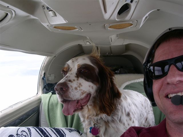
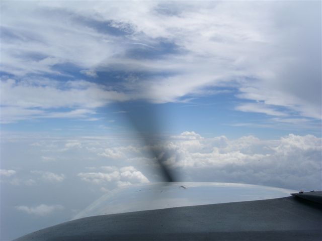
Our previous dog Murphy had flown with me a regularly in Cessna 152s and 172s and always enjoyed sitting up for takeoffs and landings but laying down to go to sleep while we were in the air. Nelson is a completely different animal (both literally and figuretively!). He isn't at all interested in laying down to sleep but rather stands up the entire flight looking out the side windows or leaning over the front seat backs to enjoy the view out front -- truly a pilot's dog! As we worked our way Southeast we did fly in IMC for around an hour and a half in very heavy haze/clouds but with a smooth ride and just severely limited visibility. Snapped this shot to show people what IMC looks like at altitude...
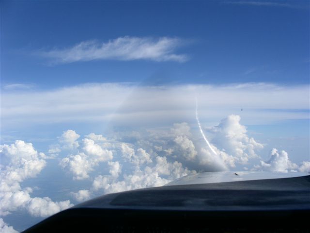
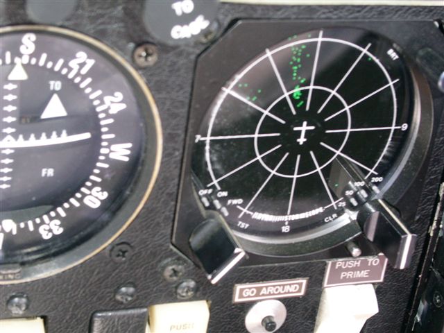
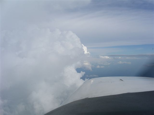
Fortunately as we headed into North Georgia the weather cleared up and what we saw was good weather with scattered but easily visible thunderstorms around that we could avoid visually and see on the stormscope as you can tell from the pictures below...
Soon enough we were talking to Atlanta approach and dropped down to pass below the traffic flying in and out of KATL as we made our approach into Griffin-Spalding County. This is clearly a small airport with that great "small airport feel" - lots of cropdusters and working planes visible and not much else. Pulled up to the FBO for some self serve fuel and gassed up the plane after letting Nelson walk around for a bit and have some water. He was perfectly content to lay in a patch of shade in some serious heat and humidity while I refueled! After a quick stop we were soon airborne and talking to Atlanta approach to pick up our flight plan to Venice as we headed South. As expected, this would be the toughest part of the trip as there was line of thunderstorms covering the West coast of Florida from Naples all the way to just South of the panhandle and then stretching to the East across the state almost to Jacksonville.
Once talking to my initial plan was to work to the East around the storms, fly down the center of the state and then head West to Venice, but the helpful controllers and flight watch briefers felt a better option was to head Southwest and fly down Florida's eest coast around 30 miles offshore leaving the weather to my east (the weather was slowly moving east and they felt it would be clear of Venice by the time I got that far south). Of course the best laid plans are only as good as what you see when you get there. The line of thunderstorms had broken up into several big cells and a helpful Jacksonville Center controller helped me pick my way through them, first over the Gulf of Mexico, then southeast almost to Gainesville, FL, then almost straight west to the coast and finally south down the coast in good weather with the storms to my east....
Didn't get any pictures while I was dodging the weather, but finally broke clear North of Tampa and got a number of good shots....
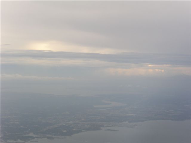
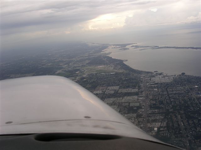
Approaching Tampa from the North...Tampa Bay is visible near the horizon...
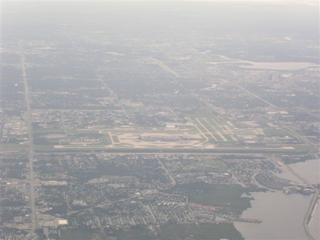
St. Petersburg Airport (flew almost right over it)
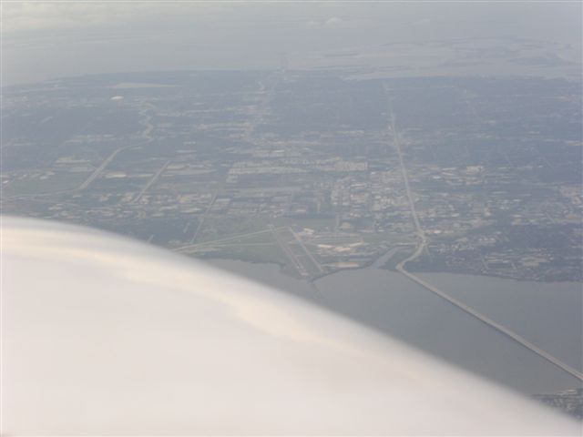
Great view of Tampa International as I flew by at around 6,000' just West of the field...
Tampa Bay
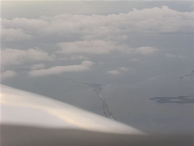
The Tampa Sunshine Skyway bridge (not too much sunshine!)
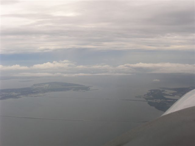
Approaching Sarasota from the North (KSRQ is visible in the center of the picture)
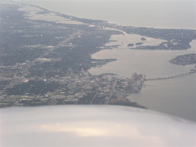
Downtown Sarasota
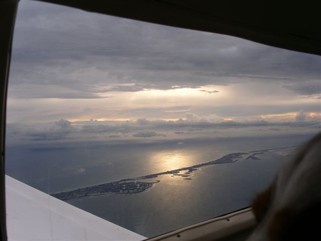
Finally I was treate to this lovely sunset over one of the barrier islands as I approached Venice and came in for landing to see my happy family...
Didn't get any pictures on the trip home with my son but it also went well. We did have to divert to a field near Atlanta for an unscheduled bathroom break (the wonders of travelling with a child) and then completed a planned refueling at Scott County Airport in Oneida, Tennessee (I've stopped there before on previous trips between Florida and Illinois), but were home in plenty of time to pick up my wife and daughter. As a matter of fact, their flight departing Fort Myers was delayed several hours and we actually had time for dinner, went home and settled down before driving to Midway to pick up the rest of the family. All told our door-to-door time was over an hour shorter than my wife's was (but of course she still maintains at least she could get up, walk around, and use a bathroom if desired while flying so I guess it's a matter of perspective...). The trip would certainly have been faster had on gone on oxygen and flown higher to take advatage of the Mooney's ability to get high true airspeeds at altitude, but taking the dog for the whole trip and flying back with my son was truly priceless! For those interested in trip stats, here they are:
| Leg | Flight Time | Distance (NM) |
|---|---|---|
UGN-6A2 |
4.1 hours |
577 |
6A2-VNC |
2.8 hours |
381 |
Subtotal |
6.9 hours |
958 |
VNC-51A-SCX |
4.2 hours |
574 |
SCX-SME-UGN |
2.8 hours |
391 |
Subtotal |
7.0 hours |
965 |
Total trip |
13.9 hours |
1923 |
Back to: N99376 homepage N99376 trips